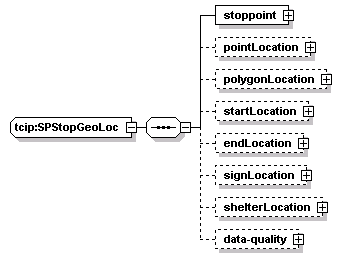
| element | tcip:SpGeolocationData/stoppoint-locations/stoppoint-location |
<xs:sequence>
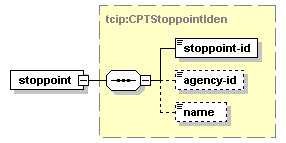
<xs:element name="stoppoint" type="CPTStoppointIden"/>
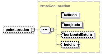
<xs:element name="pointLocation" type="lrms:GeoLocation" minOccurs="0"/>
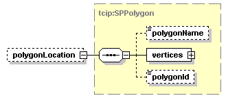
<xs:element name="polygonLocation" type="SPPolygon" minOccurs="0"/>
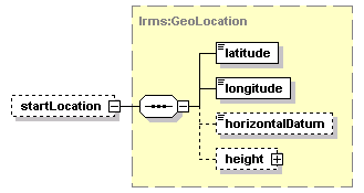
<xs:element name="startLocation" type="lrms:GeoLocation" minOccurs="0"/>
<xs:element name="endLocation" type="lrms:GeoLocation" minOccurs="0"/>
<xs:element name="signLocation" type="lrms:GeoLocation" minOccurs="0"/>
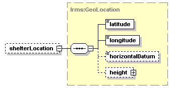
<xs:element name="shelterLocation" type="lrms:GeoLocation" minOccurs="0"/>
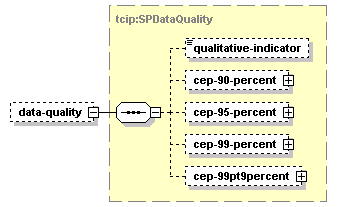
<xs:element name="data-quality" type="SPDataQuality" minOccurs="0"/>
</xs:sequence>
</xs:complexType>