| elements | tcip:CcGISFile/layers/layer tcip:SpGIS/layers/layer tcip:SpGISPush/layers/layer |
<xs:sequence>
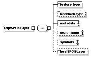
<xs:element name="feature-type" type="CPT-FeatureType"/>
<xs:element name="landmark-type" type="PI-LandmarkType" minOccurs="0"/>
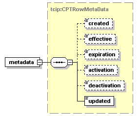
<xs:element name="metadata" type="CPTRowMetaData"/>
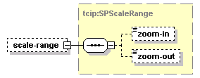
<xs:element name="scale-range" type="SPScaleRange" minOccurs="0"/>
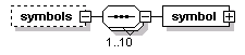
<xs:element name="symbols" minOccurs="0">
<xs:complexType>
<xs:sequence maxOccurs="10">
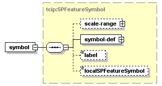
<xs:element name="symbol" type="SPFeatureSymbol"/>
</xs:sequence>
</xs:complexType>
</xs:element>
<xs:element name="localSPGISLayer" type="local:SPGISLayer" minOccurs="0"/>
</xs:sequence>
</xs:complexType>