 |
 |
|
SAE J2735-Draft-Rev29 [issued: 12-11-08]
-
260 -
This is an SAE Motor Vehicle Council draft document of the DSRC committee, subject to change.
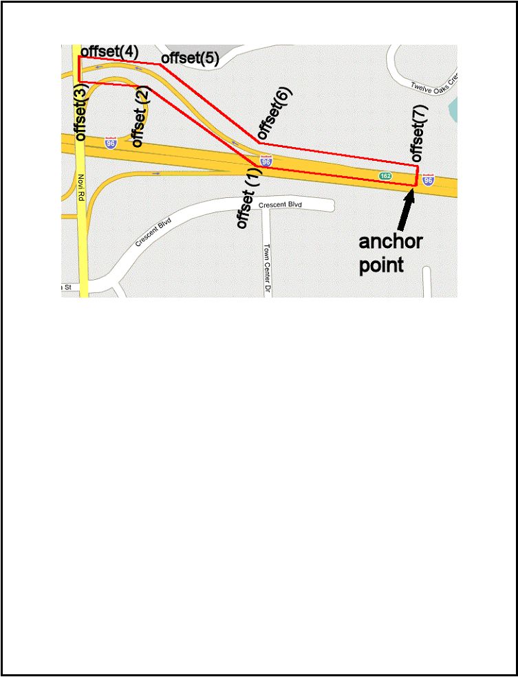
Figure 8: Polygon Region
Shape Point Set Region
An alternate form of valid region is the shape point. It allows a spline-like representation of a road
segments using the same concepts developed for DSCR map fragments and is intended to tightly bind the
region to the contour of a particular road. The described segments use the node list to efficiently describe
the contour of the roadway center line as well as any changes in width and elevation (optional elements
used only when needed).
ASN.1 Representation:
ShapePointSet ::= SEQUENCE {
anchor Position3D,
laneWidth LaneWidth OPTIONAL, -- initial width
nodeList NodeList, -- path details of the lane and width
...
}
where:
NodeList ::= SEQUENCE (SIZE(1..64)) OF Offsets
Offsets ::= SEQUENCE {
xOffset INTEGER (-32767..32767),
yOffset INTEGER (-32767..32767),
zOffset INTEGER (-32767..32767) OPTIONAL,
width LaneWidth OPTIONAL
-- all in signed values where
-- the LSB is in units of 1.0 cm
}